GISBox Official Teams: https://teams.live.com/l/invite/FEAr12sInvEVy4hFQE
Official Teams Group: https://teams.live.com/l/invite/FBAFp0pbqhqlpe1BQI
In today's digital age, geographic information systems (GIS) have long been widely used in many fields such as urban planning, environmental protection, transportation, agriculture, and energy. From smart traffic dispatching in cities to real-time monitoring of the ecological environment; from the implementation of precision agriculture to data analysis of geological exploration, GIS plays a key role. Today, I recommend five easy-to-use GIS software to help you solve related problems.
GISBox
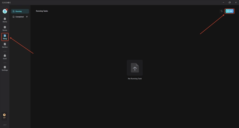
GISBox focuses on the processing and publishing of geographic information data. It supports a variety of common GIS file format conversions, such as the ability to flexibly convert OSGB format to 3DTiles format, making it convenient for users to switch between different formats to meet diverse needs. Its real-time editing function is very impressive. It can repair broken surfaces, press down riverbeds, align terrain, and other operations on oblique photography models, greatly improving the efficiency and quality of data processing. For example, for teams engaged in urban 3D modeling, using GISBox to edit oblique photography models in real time can quickly repair model defects and make them more in line with the actual terrain.
In terms of service publishing, GISBox also has outstanding advantages. It provides free service publishing functions and supports multiple data publishing protocols such as 3DTiles, Terrain, and Wmts. This is undoubtedly a great boon for small teams and individual users with limited budgets. Moreover, it also supports the integration of multiple services into a collection for publishing. The operation is simple and users can complete the publishing process in a few steps. The published services can be directly applied to GIS engines such as Cesium or Cesium for Unreal, and can also be used to build a platform for digital twin projects.
- SuperMap It is comprehensive and powerful, covering multiple aspects such as map making, spatial analysis, and data management. In spatial analysis, SuperMap supports multiple complex analysis functions such as topology analysis, network analysis, and buffer analysis, which can help users deeply explore the potential information behind geographic data. In terms of map making, it provides a rich symbol library and templates, so that users can easily create professional and beautiful maps. In terms of compatibility and scalability, SuperMap performs well, supports multiple data sources, and can be seamlessly connected with common databases, making it convenient for users to integrate data from different sources. At the same time, it also provides a wealth of secondary development interfaces, whether it is web, mobile or desktop development, it can meet the diverse customization needs of users.
- MapInfo MapInfo is a classic desktop GIS software, famous for its simple and easy-to-use interface and excellent visualization capabilities. It has outstanding performance in data visualization and basic geographic analysis. Users can quickly present geographic data in the form of intuitive maps without complex operations. In terms of data processing, MapInfo supports common vector data formats and can perform simple data editing, query and statistical analysis. It also has certain chart making functions, which can display the analysis results in various forms such as bar charts and pie charts to facilitate users to understand the data.
- GRASS GIS GRASS GIS is a long-standing open source geographic information system software, and data processing is its strength. It supports a variety of data formats, whether it is common vector data or complex raster data, it can easily cope with it. In terms of terrain analysis, GRASS GIS provides a wealth of tools to create high-precision digital elevation models, accurately calculate terrain parameters such as slope and aspect, and provide strong support for terrain research. For example, in mountain terrain research, using GRASS GIS to analyze terrain data can clearly understand the changes in mountain slopes and the distribution of slope aspects, providing an important basis for mountain engineering construction and ecological protection. In terms of remote sensing analysis, it supports a variety of remote sensing data formats, has powerful image processing and analysis capabilities, can perform image classification, change detection and other operations, and help users extract valuable information from remote sensing images.
- Global Mapper Global Mapper, developed by Blue Marble Geographics, is an "all-round player" in the field of geospatial data processing and occupies an important position in the GIS field. In terms of data processing, Global Mapper performs well and supports more than 300 spatial data formats, including common vector data formats such as Shapefile, KML, GeoJSON, etc., raster data formats such as TIFF, JPEG, PNG, GeoTIFF, etc., and even 3D models, terrain data, etc., which can be easily processed. In terms of terrain analysis and 3D modeling, it provides powerful tools for users to perform elevation analysis, slope and aspect calculation, view occlusion analysis, path analysis, etc. It can also create highly detailed and realistic 3D models to achieve 3D visualization of terrain. In short, these five GIS software have their own advantages. When choosing, you should combine your actual needs, budget, technical level, data format and other factors to find the one that suits you best.